


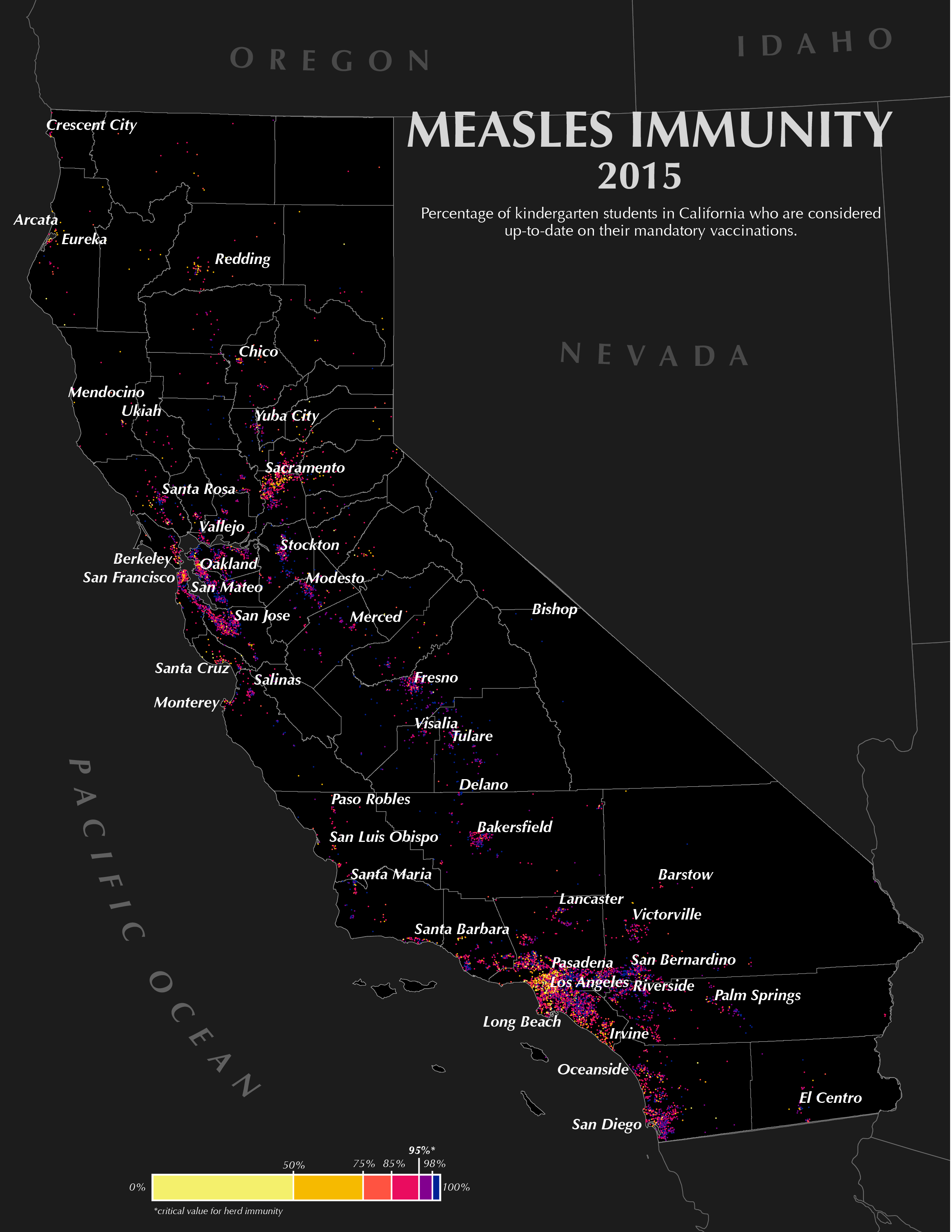
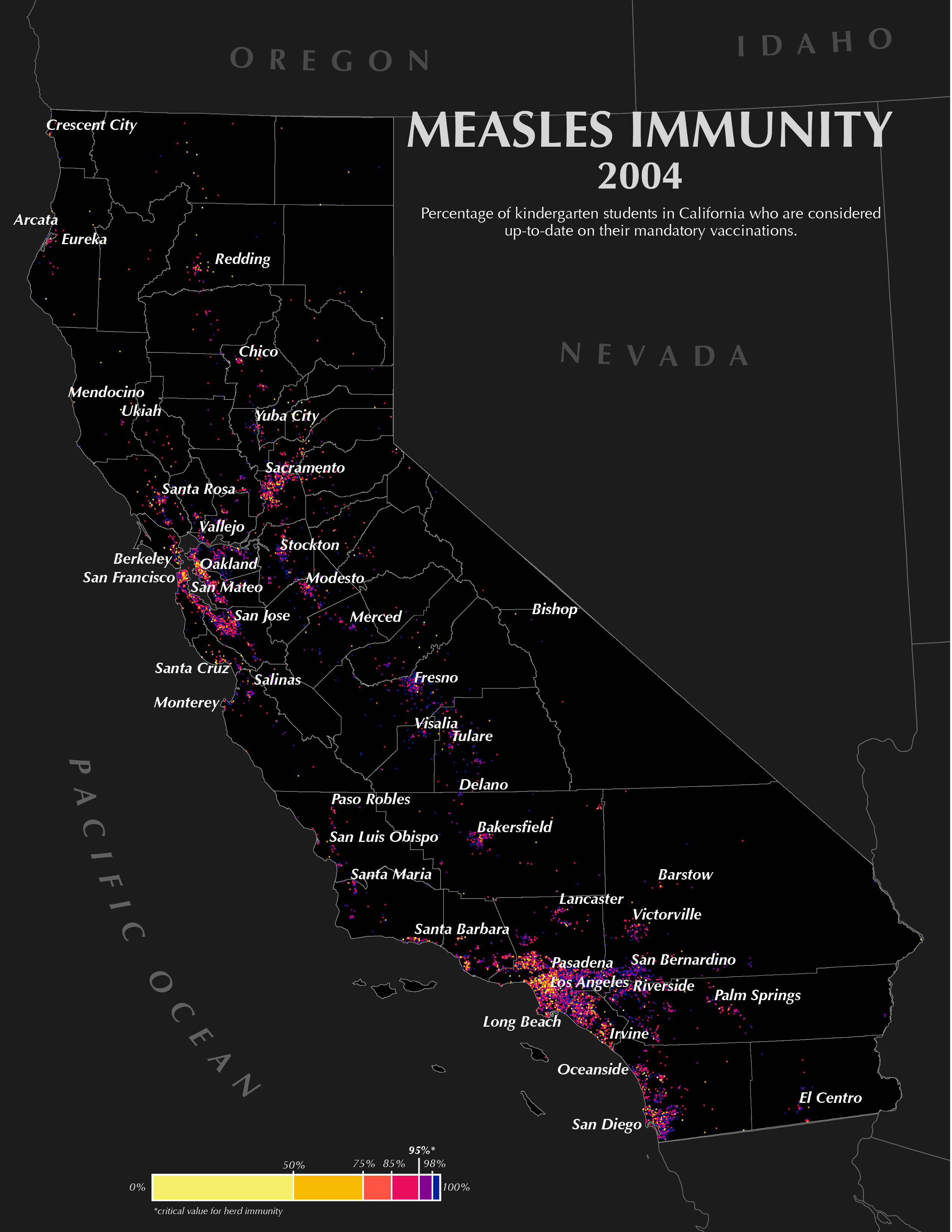

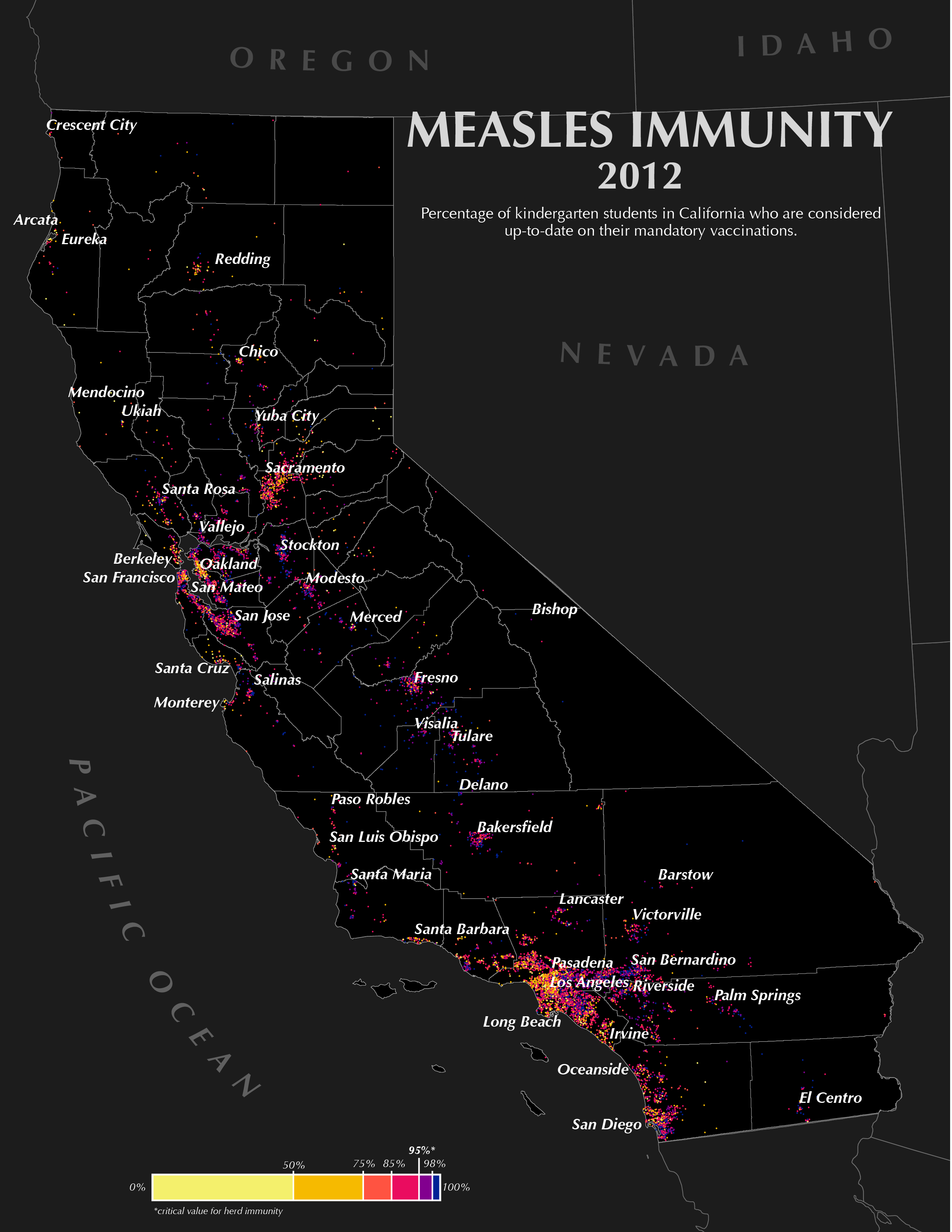
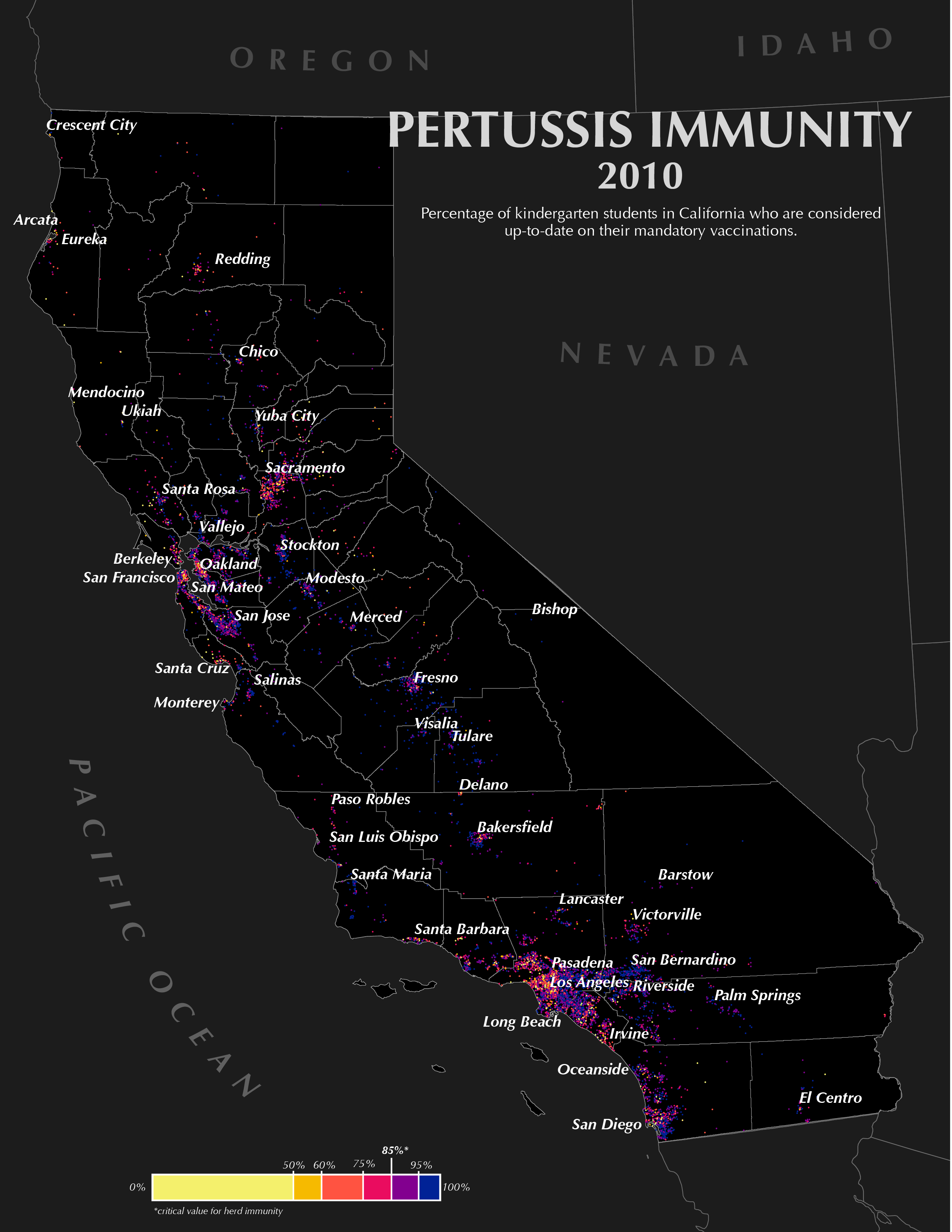
Click on any map to view larger on its own.
Click on any map to view larger on its own.


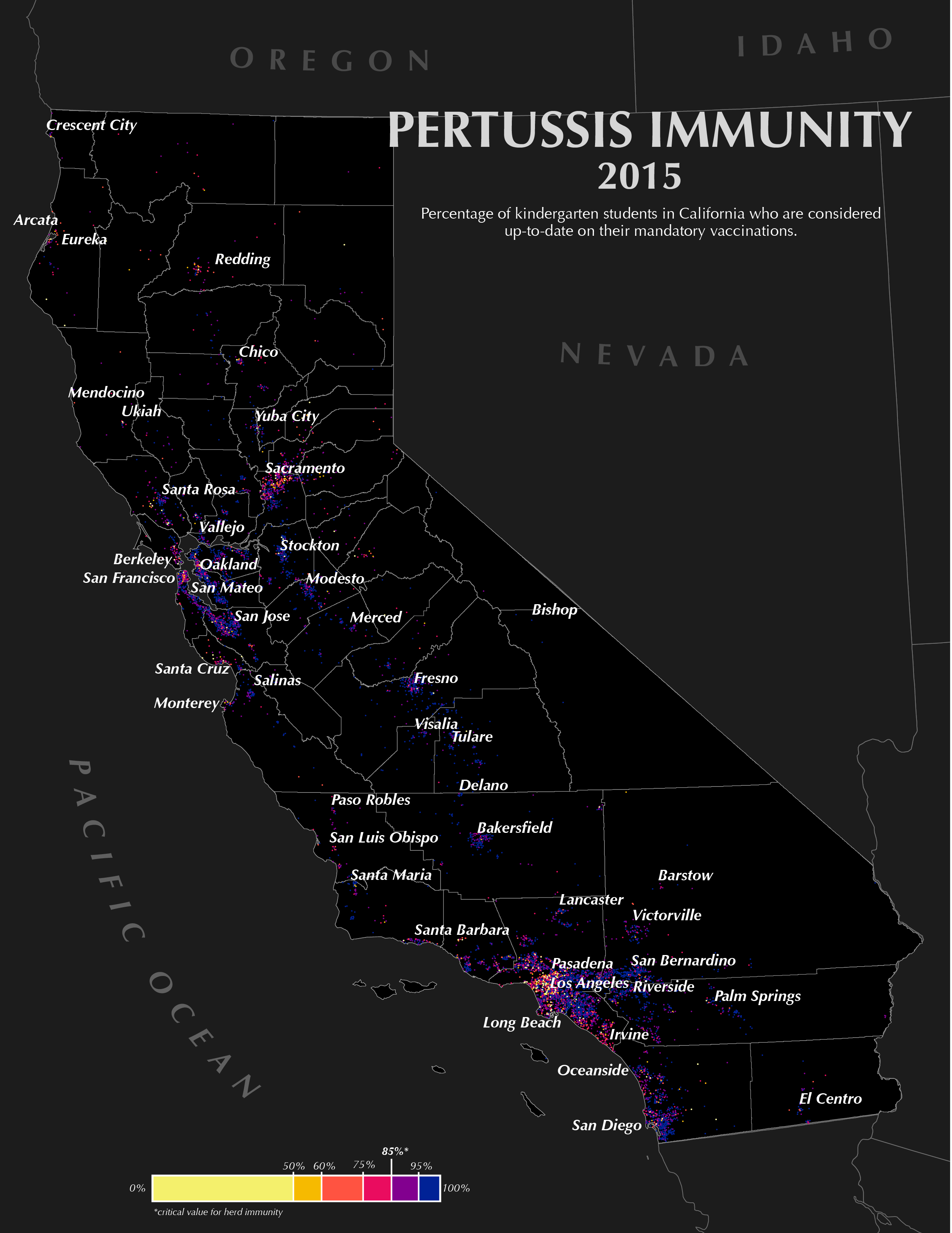


All maps and graphics created by Ellie Milligan
For completion of the Master of Science degree in Cartography and Geographic Information Systems at the University of Wisconsin - Madison in April 2019, in conjunction with Dr. Malia Jones and the University of Wisconsin Applied Population Lab.
Data Sources: California Department of Public Health, Centers for Disease Control and Prevention, Vaccines.gov, ShotsForSchool.org
Maps: Data from the California Department of Public Health, California Department of Education, Natural Earth Data, and Data.gov // Projection: NAD 1983 HARN California Teale Albers